In which: my map misleads ● up and down is the order of the day ● I reach a high point ● a new path is traced ● the day concludes with trespassing
Date: 1 October 2020 Time of walk: 1505 to 1750 Today’s walking: 10.7 km Progress along SWCP: 4.8 km Estimated ascent: 600 metres
I didn’t get to walk the South West Coast Path in 2018 or 2019, and initial thoughts of a visit earlier in 2020 were knocked on the head by the Covid pandemic, but with things sufficiently calm in southern England, I found five nights at a Premier Inn in Honiton for £29 a night. I didn’t have a clear plan as to where I might walk and when, whether I would restrict myself to out-and-back walks, or whether I might use the train or bus or taxis, but decided to leave things very casual.
I drove down from Suffolk via Dorchester, and started the walking part of this holiday by parking the car by the road bridge over the River Char at Charmouth.
My Ordnance Survey map guided me up the fairly steep tarmacked Stonebarrow Lane, but I was struck by the absence of signs for the South West Coast Path – though it has been my experience that signs in urban areas or leaving urban areas can be a little lacking, whereas in rural areas where the route is obvious, signs are prolific. Anyway, I knew where I was and that I was on the marked route on my 2020 Ordnance map.
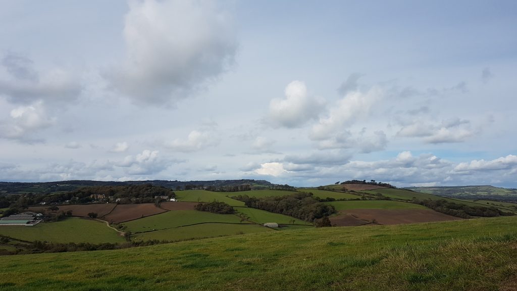
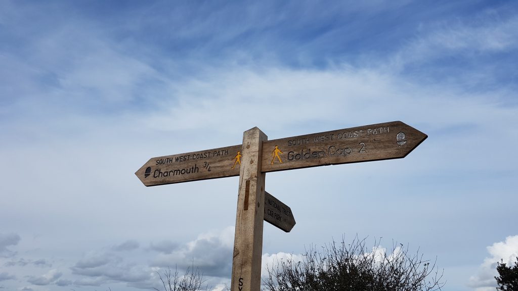
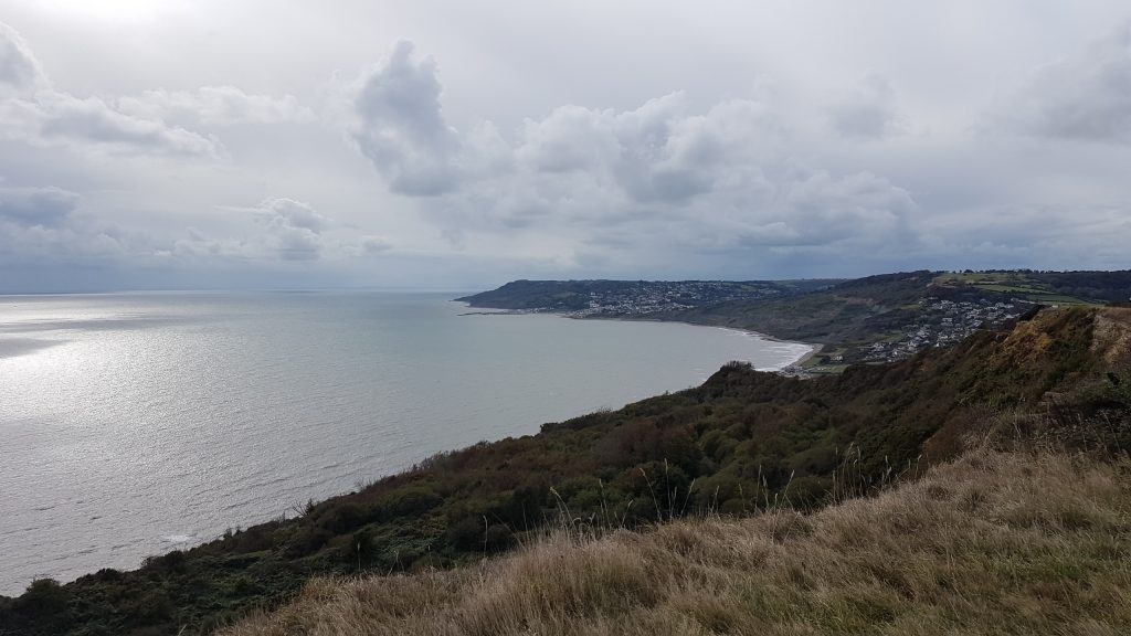
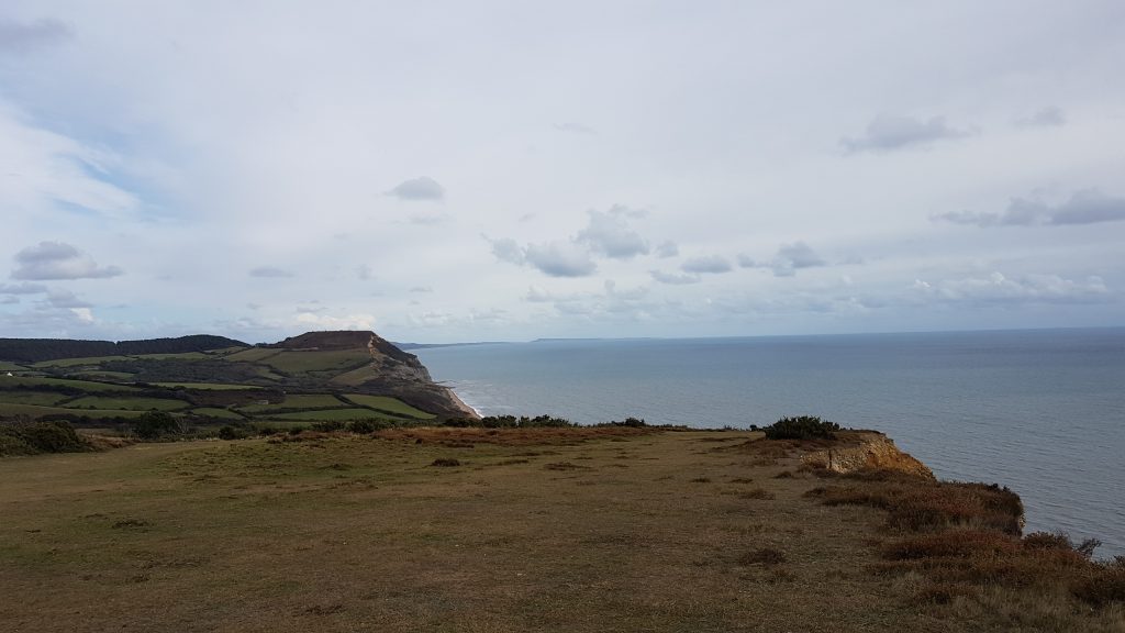
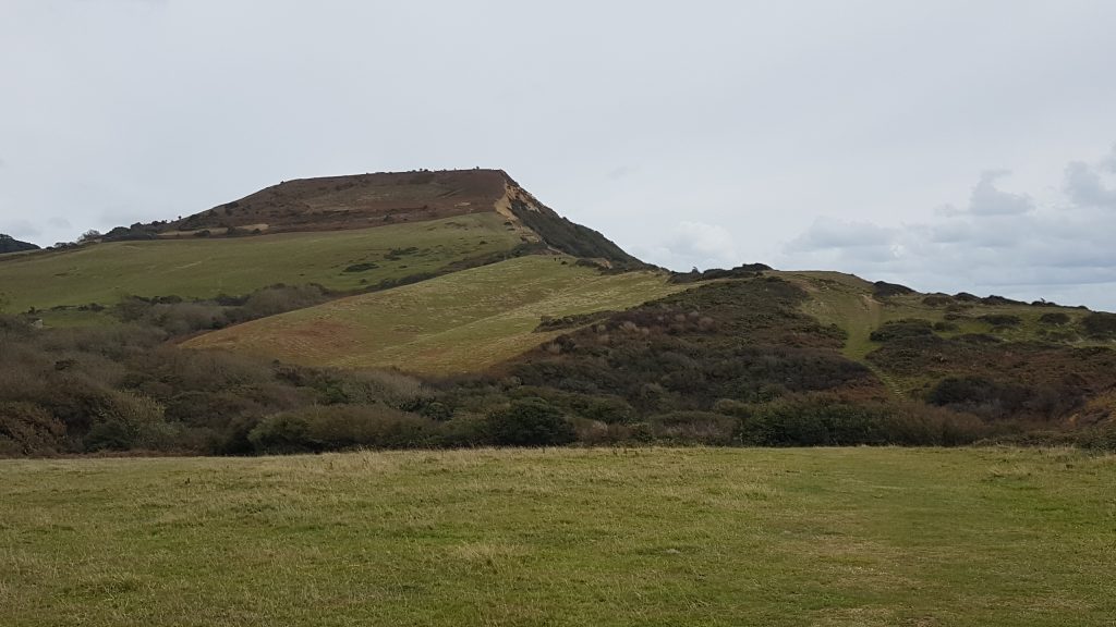
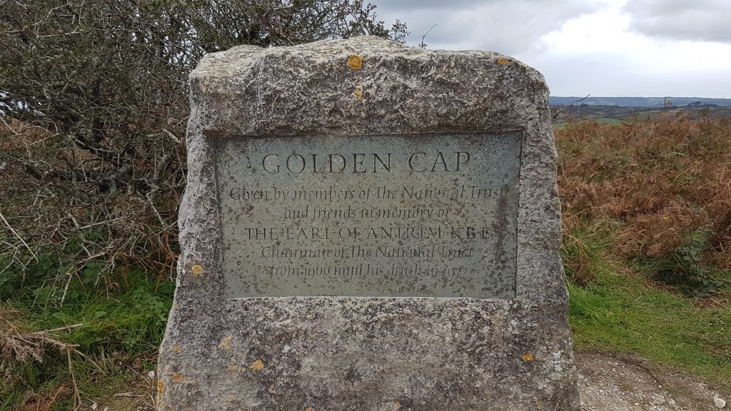
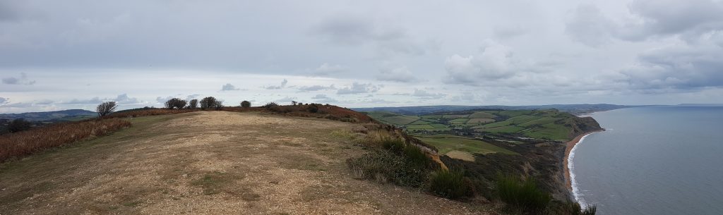
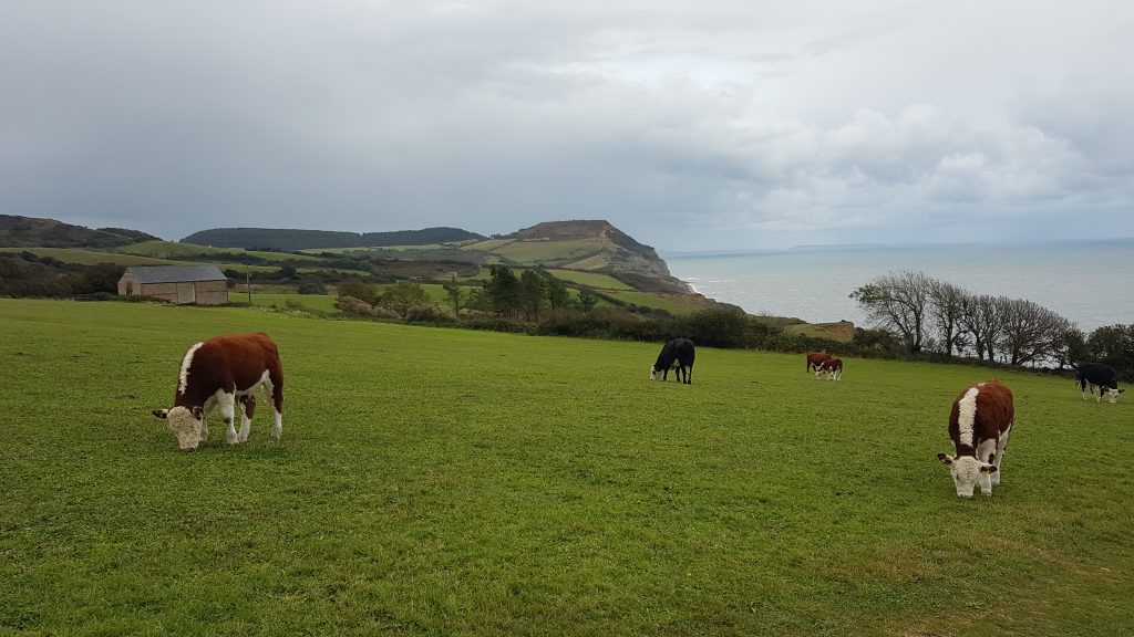
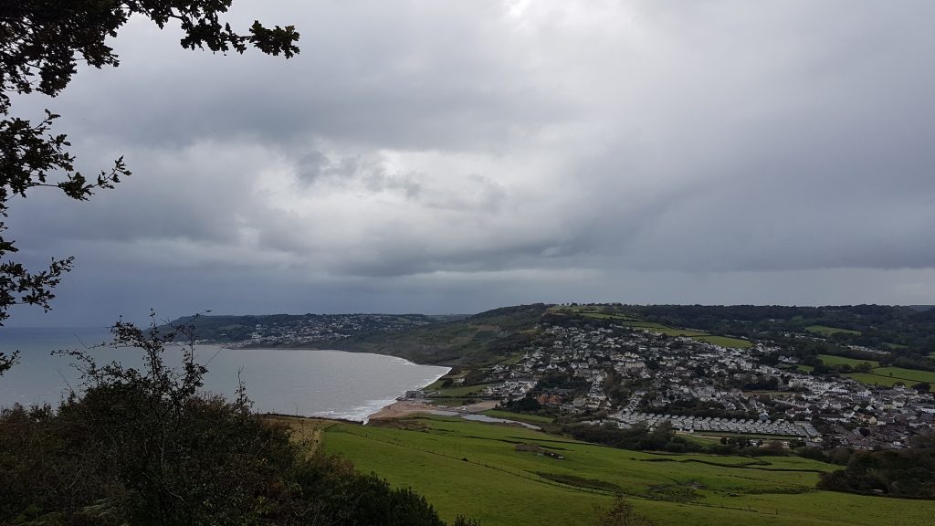
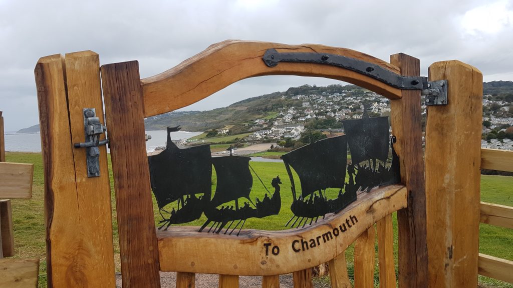
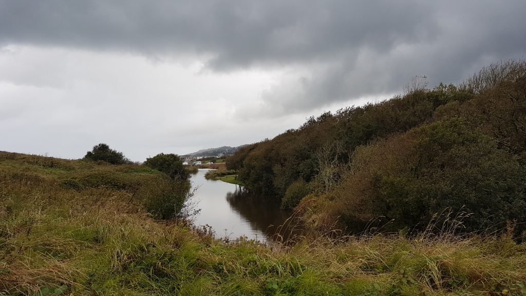
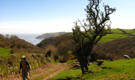
Views of west Dorset climbing Stonebarrow Lane. At the top of the hill, at the National Trust car park, I turned right and headed for the cliff tops.And here’s what I found – a sign showing that the official Coast Path doesn’t come via the car park, but instead comes up the cliff path, not even shown as a complete public footpath on my map. It’s just as well I’m doing an out-and-back walk, and so I can return to Charmouth that way later on.Looking back to Charmouth in the near distance, with Lyme Regis with its harbour of The Cobb a bit further away.Ahead lies the flat-topped Golden Cap, my objective for this afternoon, with the coast running on all the way to Portland Bill about 42km away.After down and up, I am getting closer, with another down and the prolonged upOn the summit of Golden Cap, highest point on the south coast of England.As I return, initially over the same route, a look back to Golden Cap – though these cows weren’t here on the way out!Descending by the more coastal route along the new Coast Path back towards Charmouth.A lovely new gate on the new path.I went as far as the eastern end of the footbridge over the Char, and then headed inland along a public footpath, which then totally disappeared and was impenetrable through a broad field boundary and ditch, so being close to the car, in the rain, I resorted to climbing gates and fences to get around the obstruction and regain the public footpath back to the car. A shame to end the walk like that, but at least I didn’t have to retrace my steps and it didn’t add much time once I’d decided the right of way was blocked.


 by
by