In which: the rain ceases after almost 48 hours ● blue plaques tell incomplete tales ● a landlocked island tells stories of the past ● I explore the verdant Undercliffs ● trees almost block my way to a sea view
Date: 4 October 2020 Time of walk: 1410 to 1650 Today’s walking: 10.6 km Progress along SWCP: 5.3 km Estimated ascent: 440 metres
In my geographical presentation of the South West Coast Path, today’s out-and-back walk covers the first half of the Axmouth to Lyme Regis Undercliffs National Nature Reserve, though chronologically I walked the other half two days earlier on this out-of-order holiday.
After a morning in the Premier Inn at Honiton, watching the elite-only version of the London Marathon, waiting for the rain to stop and recovering from a bad night’s sleep after being dragged out into the cold and rainy car-park at midnight when the fire alarm went off, I drove to Seaton, parked the car and headed east.
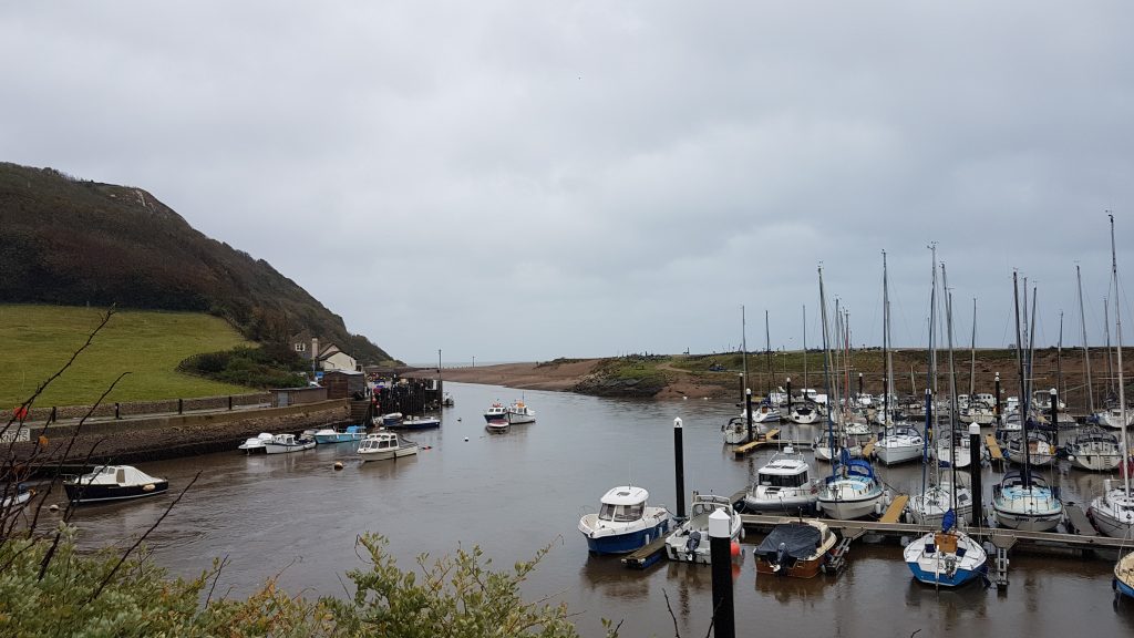
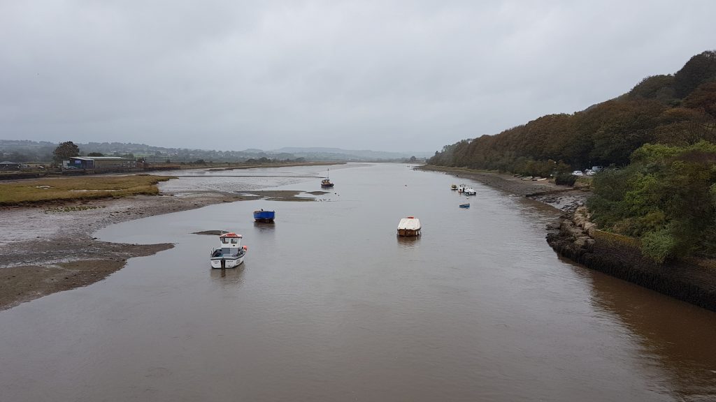
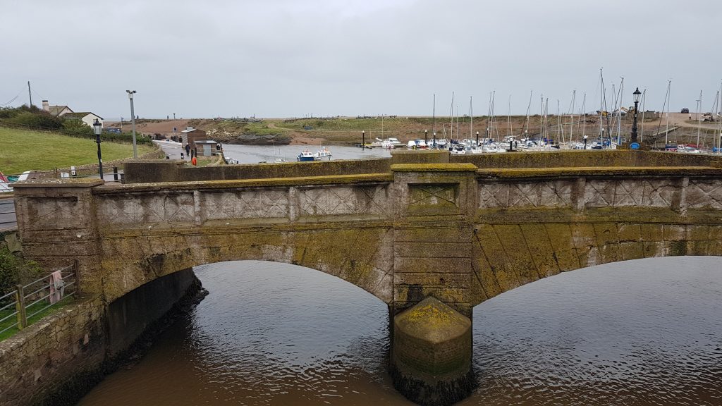
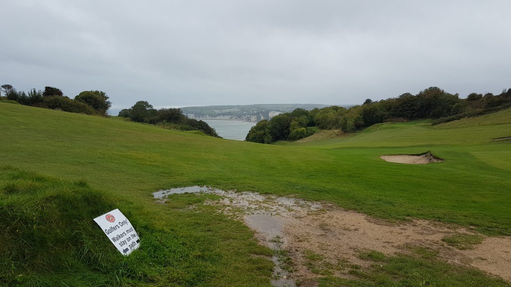
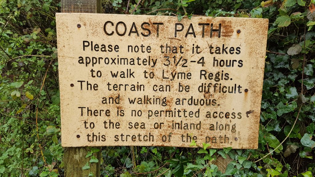
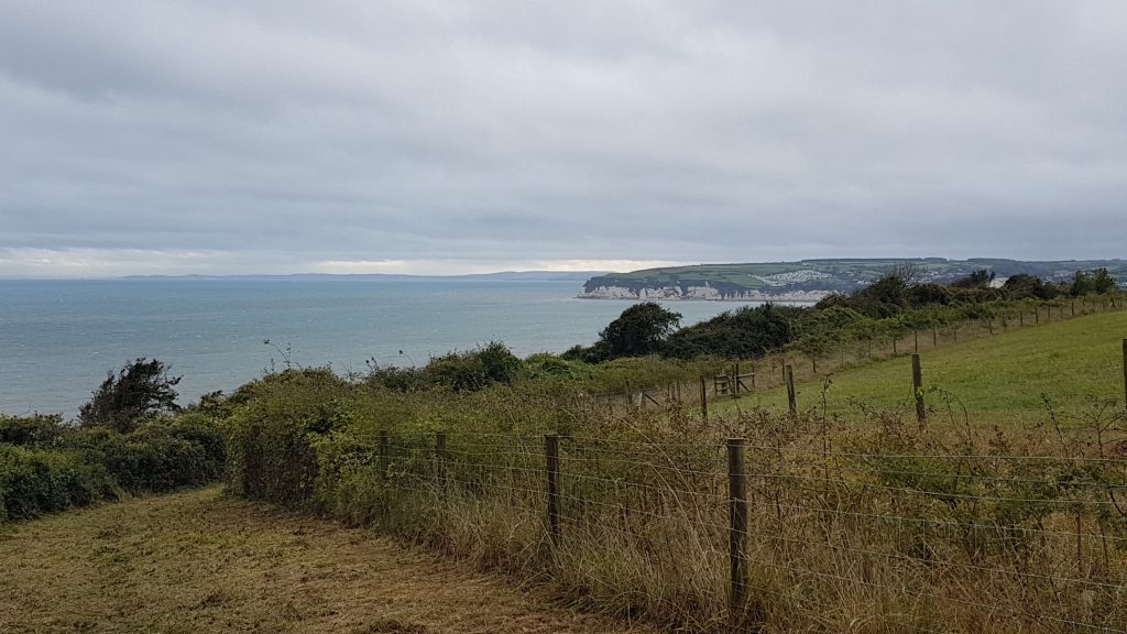
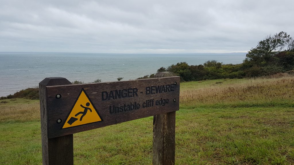
The first task of the walk is the crossing of the Rive Axe, with two bridges to choose from. Here I look south to the sea which is just behind the single bankIn the other direction, from the modern and more northerly road bridge, looking up the AxeThe old concrete bridge across the River Axe, from the modern bridge. The old bridge has a blue historical plaque, which states “Scheduled Ancient Monument. Axmouth Old Bridge, opened 1877, closed to traffic 1990. This is the oldest standing concrete bridge in England”. Interestingly, I’ve been to another concrete bridge at Homersfield where it spans the Norfolk/Suffolk border. It too bears a blue plaque which states “The Institution of Civil Engineers. The Oldest Concrete Bridge in Great Britain. Homersfield Bridge. Built in 1870.” It’s definitely still standing, and I’ve walked across it, though it has had some restoration work – whether that’s involved in the difference of opinion, I’m not sure. My best guess is that it’s down to the Homersfield Bridge being iron-reinforced concrete whereas the Axmouth Bridge is mass concrete, but neither blue plaque makes it very clear.After I’d taken my photos from the bridges, I set off again, and a couple paused to let me past. It wasn’t clear that I was going faster than them, but in this Covid-paranoid age some people just don’t want to be anywhere near you even if it’s obviously even lower risk to be in front of someone than behind them. So I walked as briskly as I could up the well-surfaced steep tarmac lane to the golf club, and then continued the ascent over the golf course, looking back across Seaton Bay. This is a mirror of the sign at the other end of the Undercliffs walk. I reckon it would have been about 2 hours 20 minutes straight through for me. The signs are odd, because apart from the lack of access (which isn’t unique) the route is no more difficult than many other sections of the coast path, and I’ve not seen similar signs anywhere else. My pace may be moderately brisk but it’s by no means quick, so the time estimates are very pessimistic.This is Goat Island, a chunk of previously arable land. An enormous landslide in 1839 left it marooned and created the western end of the Undercliffs which now run for several miles. The landslide was a huge tourist attraction with people visiting on land and in paddle steamers, including the Queen.The danger sign is a very long way back from the cliff edge. Being cautious is all very well, and some people take stupid chances too close to fragile cliff edges, but why put the sign here? There’s a tiny chance that the landslide of 1839 could be repeated one day, but in that case even this sign isn’t safe – the 1839 slide was behind me, hence giving Goat Island its name as it was left isolated, surrounded by collapsed land. Here the couple that had encouraged me to go ahead passed me.
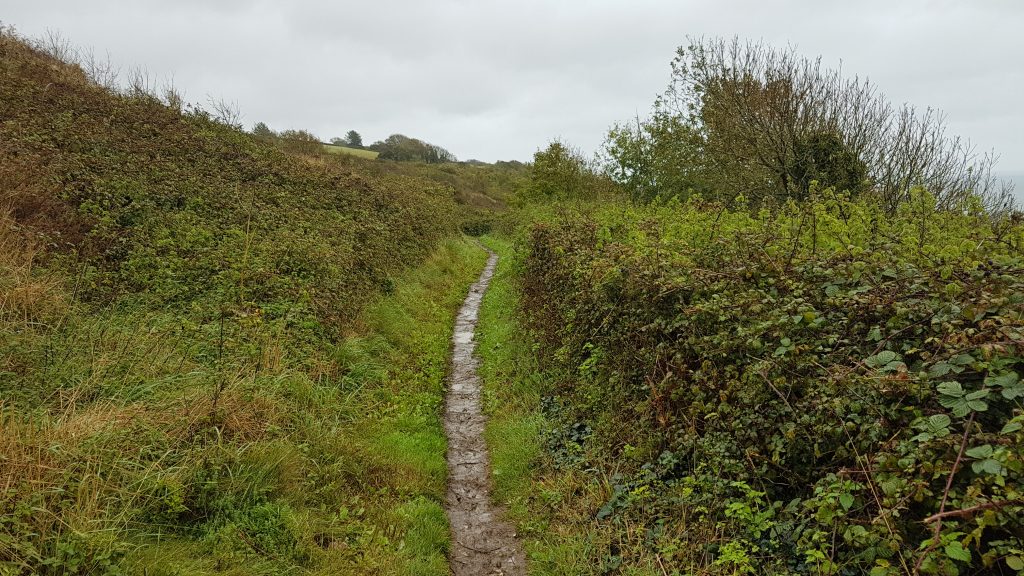
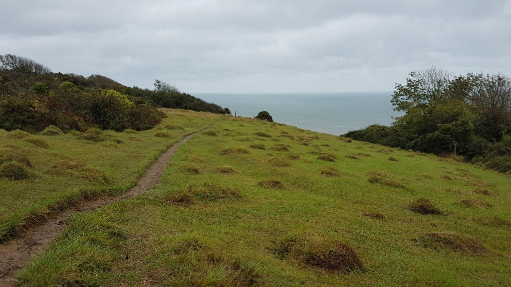
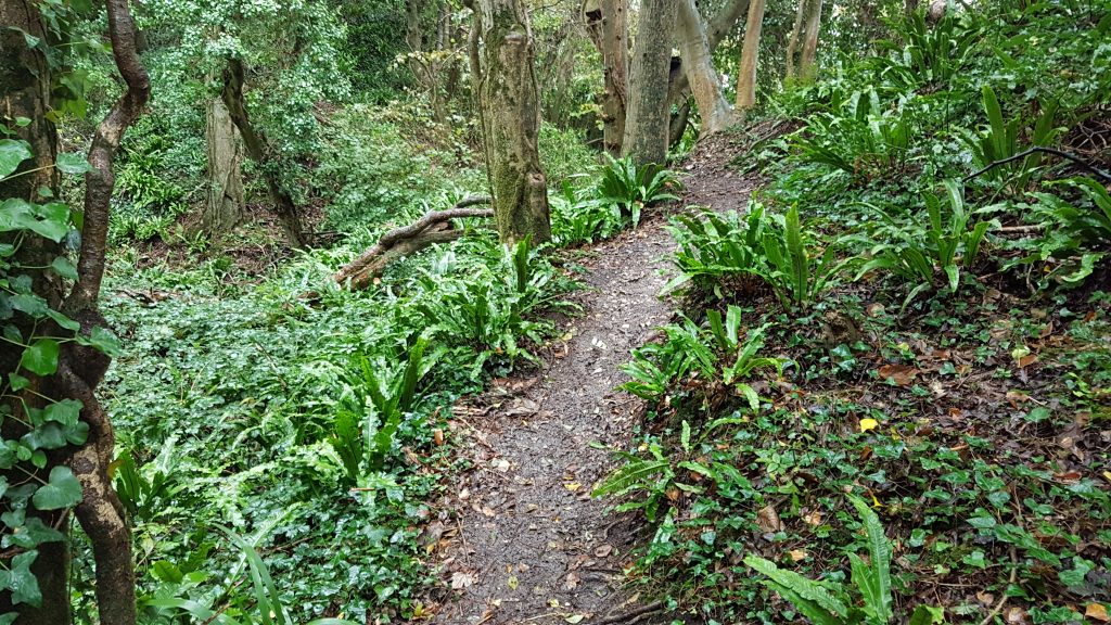
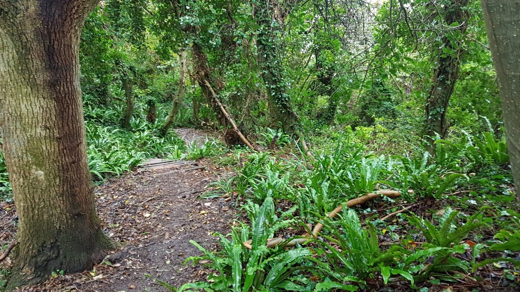
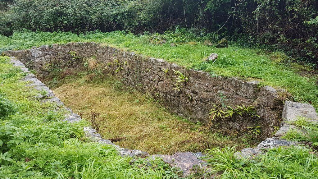
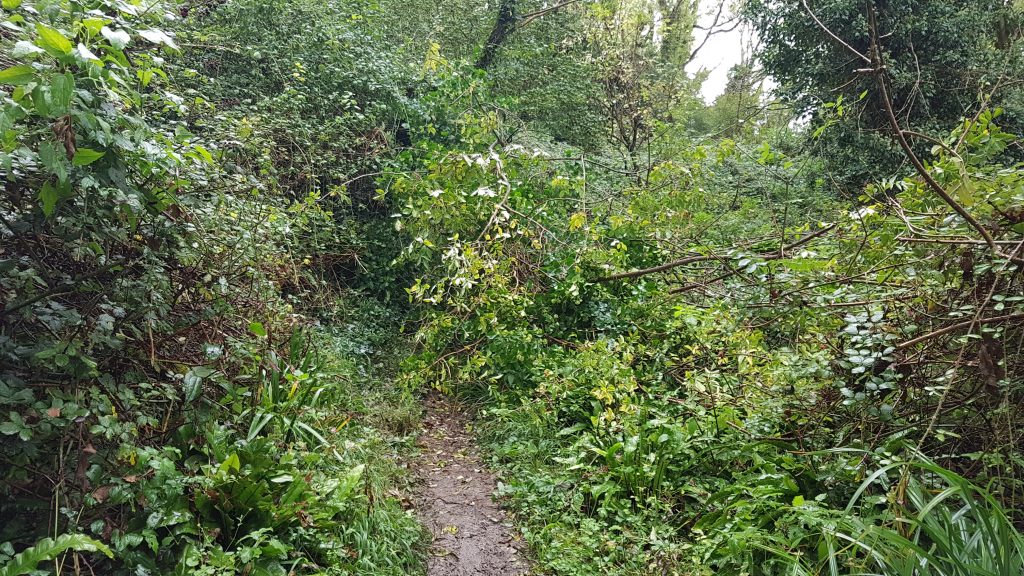
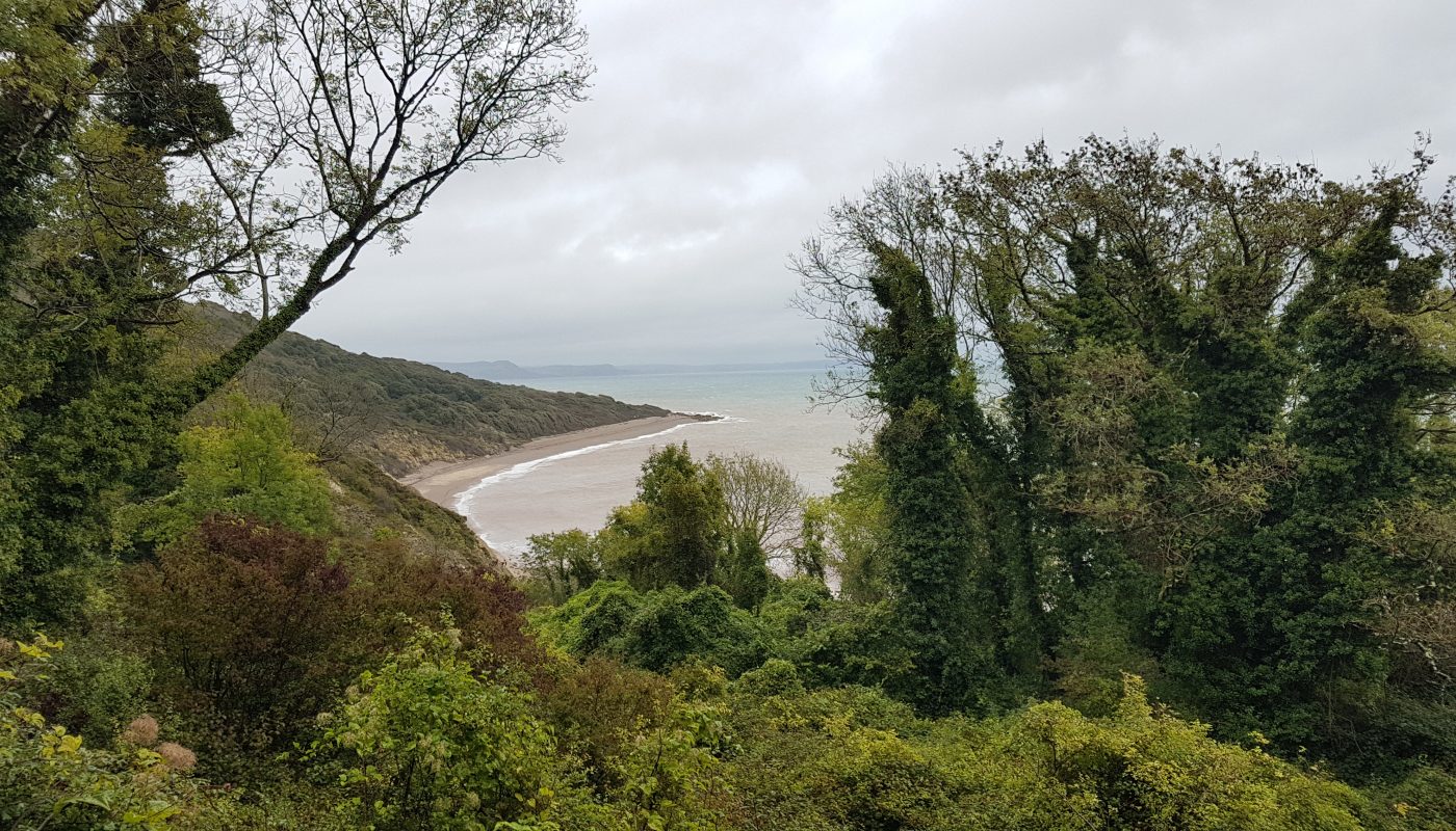
Then the walk through the Undercliffs proper starts. It’s very green (especially after the rain of the last 48 hours has left everything damp), with thick vegetation closing off almost all views of the sea to the right and the cliffs to the left.The land which was once productive is now wilderness, but there is occasional evidence of past occupation. Here a sheepwash is now marooned in the woodland, kept cleared immediately around it.One of two trees I had to make my way around in each direction. As I approach my turn-around point, I’m briefly overlapping Friday’s walk, so I know that this one has fallen in the last 48 hours.The view by the bench just past the fallen tree is the first good view of the sea since entering the Undercliffs, and shows it is time to turn around and head back to Seaton.

 by
by